Wen Jiabao Unveiled Local Image Map of Chang'e II Lunar Rainbow Bay
|
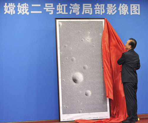
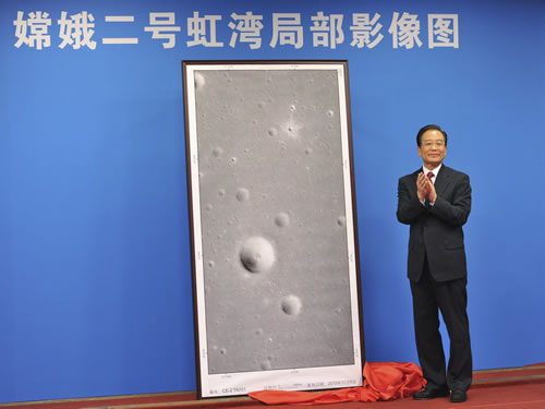
The morning of November 8, the opening ceremony of Local Image Map of Chang'e II Lunar Rainbow Bay was held in Beijing. Premier Wen Jiabao attended the opening ceremony and unveiled the Local Image Map of Chang'e II Lunar Rainbow Bay.
On October 1, China launched the second lunar probe satellite --- Chang'e II successfully. "Chang'e II" officially began the lunar probe adventure full of the wisdom and achievements of Chinese scientists, carrying the CCD stereo camera developed by XIOPM. At 0:54:11 on October 24, 2010, 100km orbit CCD stereo camera was firstly opened, the camera works fine and the image is clear; at 4:10:52 on October 27, 2010, 15km orbit CCD stereo camera was firstly opened, the camera works fine, Rainbow Bay area is imaged high-precisely, the image begins to return and is clear; November 8, 2010, Premier Wen Jiabao unveiled the Local Image Map of Chang'e II Lunar Rainbow Bay.
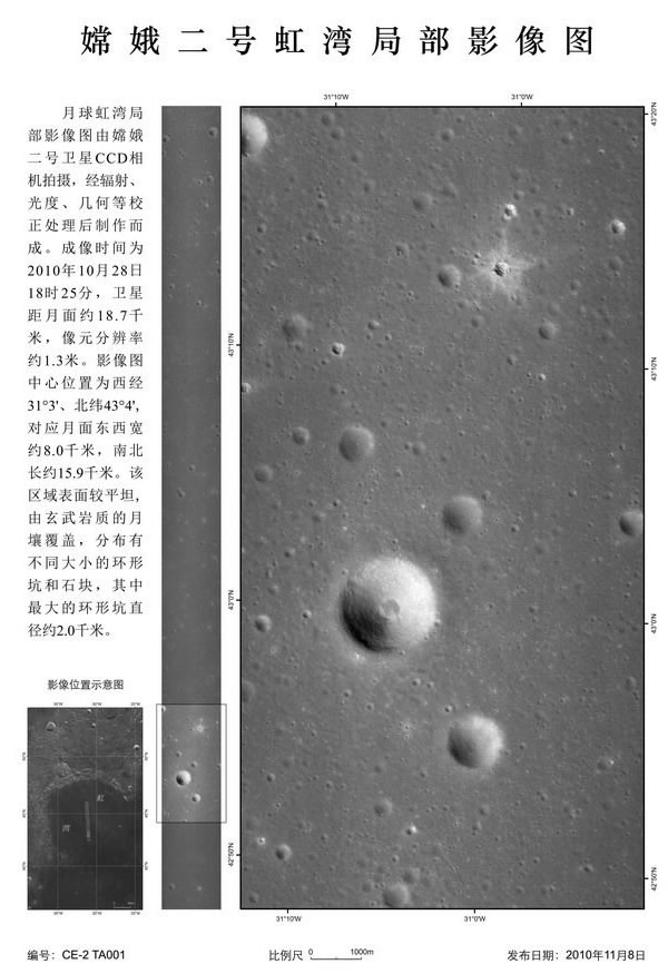
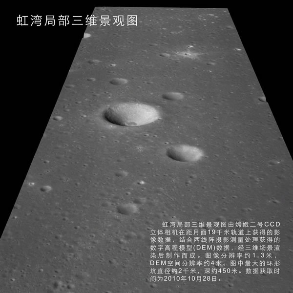
The Local Image Map of Chang'e II Lunar Rainbow Bay unveiled by Premier Wen Jiabao was imaged at 18:25 on October 28 when the satellite is about 18.7 kilometers from the lunar surface and the resolution is approximately 1.3 meters. The center location of the image map is 31 degrees 3 minutes west longitude, 43 degrees 4 minutes north latitude, and the corresponding lunar surface is of about 8 km width from east to west and of about 15.9 km length from south to north. The image map shows that the surface of the area is relatively flat, covered with basaltic lunar soil, and distributed by circular pits of different sizes and stones among which the diameter of the largest circular pit is about 2 km. The returned image marks all project goals have already achieved identified by Chang'e II and the scientific objectives are also being realized, which declares the mission of Chang'e II lunar probe project is successful completely. XIOPM makes another significant contribution to China's lunar probe. CCD stereo camera shocks people again, which embodies the efforts and wisdom of XIOPM researchers. Academician Ouyang Ziyuan, the chief scientist of China’s lunar pobe project, once spoke highly of XIOPM’s contributions to China's lunar probe project.
Local Image Map of Chang'e II Rainbow Bay (imaged on October 28)
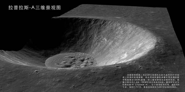
Laplace-A Three-dimensional Landscape Plan (data interception is on October 28)
Rainbow Bay, the Local Three-dimensional Landscape Plan (data interception is on October 28)
Typical Polar Crater (imaged on October 25)
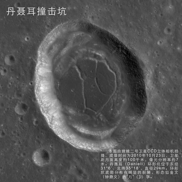
Dan Nie Er Craters (imaged on October 23) |
Chang'e II completed Rainbow Bay area filming, congratulatory letters have been sent by XIOPM leaders
|
According to domestic media reports, the Chang'e II satellite has completed the high-precision imaging for the Rainbow Bay area; pictures of these areas have been being transferred. A successfully transferring of taken pictures will mark a successful mission of Chang'e Ⅱ. The CCD stereo camera developed by XIOPM is taking this mission. It needs to take close-up shooting for the Rainbow Bay area. The task was one of the focuses of Chinese Academy of Sciences. Just after the launch of the satellite, President Lu Yongxiang had sent a congratulation letter to XIOPM, vice president Jiang Mianheng, vice president Yin Hejun also had sent their regards and congratulations to XIOPM. Vice president Jiang Mianheng made a special congratulation phone call to director Zhao Wei of XIOPM to express deep greetings and heartful thanks. XIOPM will keep pursuing the development of its tasks and make new and greater contribution for the development of space science.
|
Oriental Horizon CCTV special report on Chang'e II CCD stereo camera
|
Chang’eⅡ was launched on 1st, October. The resolution of the CCD camera was improved by 17 times than the one carried in Chang’e Ⅰ, this particular camera carried by Chang’eⅡ will take a close shot for the moon. Oriental Horizon reported XIOPMs on their program featured by “Amazing CCD camera with a 17 times high resolution”
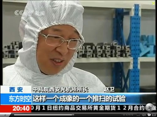
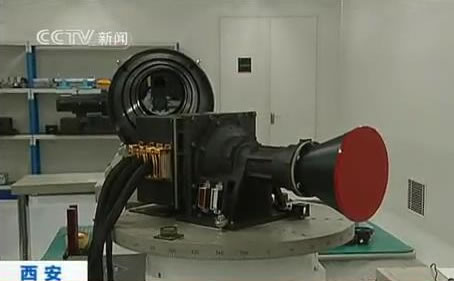
“A CCD stereo camera is a combination of optical lenses, CCD detector and signal process system, among which CCD detector is the core attachment. CCD detector will transfer optical signal captured by optical camera into electronic signal, before the signal is transferred into the storage unit in the satellite. In a high speed moving satellite, CCD stereo camera will scan the moon with push broom imaging. Push broom imaging is the technique that use the image scanned by CCD camera and combine several scanned image into a complete one.” Said Director Zhao wei during the interview.
The 120 m Resolution CCD Camera carried by Chang’e Ⅱhas been improved into 7 m high resolution. But what it means when the resolution is improved 17 times? Director Zhao illustrated that if a 120 m resolution camera could shot a picture in which a parking lot could be recognized, a 7m resolution camera could shot a picture in which the car in the parking lot could be recognized, even the outline of a car could be recognized by the camera. When it comes to the moon, lunar craters around 20 to 30 square meter could be clearly visualized with this CCD camera. The improvement on this technology had built an important foundation for future lunar exploration work.
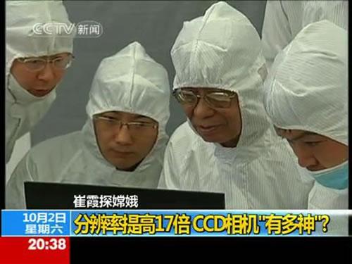
Scientist from the XIOPM demonstrated the process of how stereo camera work for the correspondence Cui xia during the interview in order to enable audiences have a better understanding on CCD stereo camera. Oriental Horizon CCTV special report: http:// space. tv. cctv. Com/video/VIDEI1286025534095882 |
Equipment developed by XIOPM attached on Chang'e II contributing lunar exploration
(China Network TV reported on 19:30, October 1st, 2010: Chang’e II set off from the carrying rocket and follow the setting orbit after 1553 seconds of its launch.) On October 1, China's second lunar satellites successfully launched. "Chang'e II" officially began the lunar exploration with the effort of Chinese scientists. In this remarkable exploration projects, CCD stereo camera developed by XIOPM will be also part of this lunar exploration mission, at the same time, the UV-RAY device and the medium accuracy optical star sensitive system developed by XIOPM will also play a major role in orientation and attitude adjustment for Chang'e II to complete its lunar exploration mission.
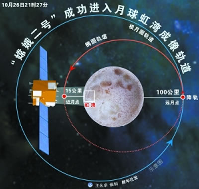
"Chang'e II" is the guiding satellite for the second phase of China's lunar exploration program. One of its important tasks is to make high precision imaging in the landing zone for the "Chang'e III" .The flying altitude of Chang'e II will be down to 100 km to the moon from 200 km ( which is the flying altitude for the Chang’e Ⅰ), and it will take a close up image for the moon . The Chang'e II "satellite CCD stereo camera on board will greatly enhance the accuracy, its resolution has been increased by 17 times than the one attached in" Chang'e I "satellite CCD stereo camera. It was 120 m resolution and now it's 7 m resolution. In order to complete the pathfinding mission more accurately, Chang'e II will also follow an extra orbit of 15 km altitude apart from its 100 km altitude orbit. In this extra orbit, Chang'e II will make its high precision detection and imaging for the landing zone (Rainbow Bay) of Chang'e Ⅲ. It can shoot up to 1 meter resolution images.
It is understood that there is no better than 10 meters resolution three-dimensional image for the moon available so far, while the "Chang'e II" CCD camera with this high-precision three-dimensional capabilities, which will lead the lunar research and the exploration for international community. Also a closer detection from Chang’e II will take place to ensure Chang'e III's safe and reliable landing.
Star sensor is an important measuring and control instrument for the satellite for motion control. In 2007, China's first lunar exploration satellite "Chang'e I" was enabled to orientated with an UV sensor. On the Chang'e II satellite, the UV light and medium optical sensor system developed by XIOPM will play a major role in the satellite orientations
Space probe is the "eyes" for space-based observations; the star sensor is called the "eye of the eyes". Star sensor will take pictures and analysis the date in the picture to ensure the satellite maintains correct posture and direction, and also it will enable the satellite to carry out exploration activities by setting requirements.


