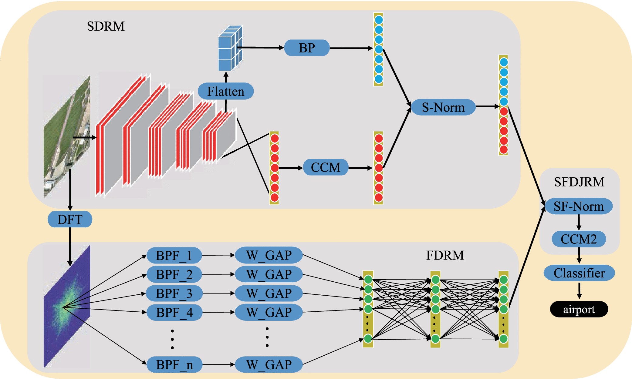
Remote sensing image scene classification is a fundamental problem, which aims to label an image with a specific semantic category automatically. Recent progress on remote sensing image scene classification is substantial, benefitting mostly from the powerful feature extraction capability of convolutional neural networks (CNNs). Even though these CNN-based methods have achieved competitive performances, they only construct the representation of the image in location-sensitive space-domain. As a result, their representations are not robust to rotation-variant remote sensing images, which influence the classification accuracy. Xiaoqiang Lu research team from XIOPM propose a novel feature representation method by introducing a frequency-domain branch to the traditional only-space-domain architecture. Their framework takes full advantages of discriminative features from space domain and location-robust features from the frequency domain, providing more advanced representations through an additional joint learning module, a property that is critically needed to perform remote sensing image scene classification. Additionally, our method produces satisfactory performances on four public and challenging remote sensing image scene data sets, Sydney, UC-Merced, WHU-RS19, and AID.
(Original research article " IEEE Transactions on Geoscience and Remote Sensing ( Volume 57 , Issue 10 ,P7492 - 7502)”, https://doi.org/ 10.1109/TGRS.2019.2913816)