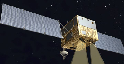
September 6, 2011, Environment and Disaster Monitoring and Forecasting Minisatellite ("Environment I" Satellite) has successfully launched for three years, "Hyperspectral Imager", the major load of A Satellite of "Environment and Disaster Monitoring and Forecasting Minisatellite" developed by XIOPM has on-orbit operated for three years and reached the designed lifetime.

HJ-1-A Satellite
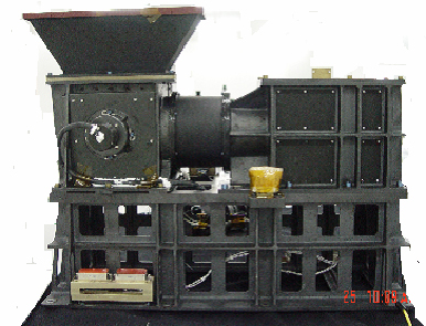
Environment Satellite Hyperspectral Imager adopts the image-forming principle of spatially modulation interference spectrum, which can simultaneously obtain bidimensional information and single dimensional spectral information of the target. It has characteristics of wide spectrum and fine spectrum (spectral detection range is 0.45-0.95mm, average spectral resolution is 5nm). It is the first satellite borne earth observation interference hyperspectral imager in our country, which filled in the gap of this field of our country.

Main Part of the Hyperspectral Imager
September 6, 2008, Environmental Satellite launched with hyperspectral Imager, and in March 2009, it was formally delivered to the customer after completing all on-orbit tests. In its three years on-orbit operation, the device operated stably, all technical indicators has reached and even exceeded the developing requirement. During the period of on-orbit operation, the hyperspectral imager has obtained hundreds of thousands of data products accumulatively, data volume has exceeded 50TB, its data has been sent to more than 70 user units including Ministry of Civil Affairs, Ministry of Environmental Protection, Ministry of Agriculture, State Forestry Administration, State Oceanic Administration, and CAS. Application research shows that the data obtained by the hyperspectral imager has provide important technical support and basis of decision-making for feature information identification and classification of land use and vegetation classification, drought monitoring and assessment, forest fire recovery monitoring, and crops assessment; and it has obvious advantage in quantitative application of algal bloom disaster monitoring, earth surface parametric inversion, and plant biomass live weight estimate; and it has application potential in aspects of scope and strength monitoring of wheat diseases and pests.
In 2009, Environment and Disaster Monitoring and Forecasting Minisatellite Hyperspectral Imager has won the second prize for the National Scientific and Technological Progress Award.
Recently, the satellite has organized relevant experts to develop the on-orbit assessment and subsequent active promotion work of Environment and Disaster Monitoring and Forecasting Minisatellite, which means the Hyperspectral Imager will continue to operate on-orbit.


